There are some destinations you visit, and you compare them to other experiences. The hiking trails here are like the hiking trails there. The snow here is like the snow there. You get the picture.
I can’t compare Sedona to another destination.
It’s not a place you visit. It is something you experience.
Spend At Least 3 Full Days In Sedona If You Hike
I recommend spending at least 3 full days in Sedona if you plan on hiking. There is a lot to see there.
We spent 4 full days in Sedona, plus travel days. Our itinerary looked something like this:
- Thursday
- Drive from San Diego to Sedona
- Hike Airport Loop in the evening
- Friday
- Hike Catherdal Rock
- Saturday
- Hike Airport Loop again, with friends who drove up from Phoenix
- Hike Soldiers Pass
- Sunday
- Hike Slide Rock National Park
- Hike Bell Rock
- Monday
- Hike Boynton Canyon
- Tuesday
- Drive back to San Diego
Hiking In Sedona: Let’s Talk About The Weather
Sedona is hot in the summer. We were there in June and got lucky with the temperatures being in the high 80s & low 90s. The week after we left, the temperature soared to over 100 degrees Fahrenheit and stayed there for weeks.
There isn’t a lot of cover from the sun (if any on most trails) in Sedona. If you are going to hike when it is hot consider starting very early in the morning and bring a lot of water, sunscreen, and a hat. Or do yourself a favor and go during the high season when it is cooler, more bearable, and safer.
Enough about the weather. Let’s get to the hiking trails and vortexes in Sedona, AZ.
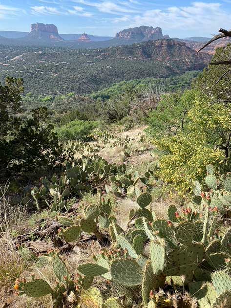
What to Expect From Sedona Hiking Trails
Hiking in Sedona reminded me of the first time I snowboarded in Utah.
I learned how to snowboard one afternoon in the Poconos. It came easily to me because of my surfing background. By the end of my first day, I was sliding down double black diamonds (difficult slopes) without much hesitation.
However, I quickly learned the following season that a black diamond in The Poconos is different from a black diamond slope in Utah.
Which brings me to hiking in Sedona. Some of the trails labeled as “moderate” on some websites, including Visit Sedona and AllTrails, were the equivalent of “difficult” based on my experience hiking on both the East Coast and in California.
Keep that in mind when you see that a hiking trail is moderate in Sedona, especially if you have children, a recent surgery, or an active injury.
What Is An Energy Vortex In Sedona?
You will hear a lot about the energy vortexes in Sedona when you are there. I didn’t quite understand them until I experienced them firsthand at Airport Mesa, Cathedral Rock, Bell Rock, and The Kachina Woman.
While the sources below will help educate about the vortexes, I think you can only understand the vortexes so much without experiencing them which I highly encourage you to do.
This video gives a great crash course on the vortexes in Sedona.
Visit Sedona has a great page about the vortexes.
If you want to learn more about Sedona energy vortexes I suggest “What Is A Vortex? Sedona’s Vortex Sites A Practical Guide” on Amazon by Dennis Andres.
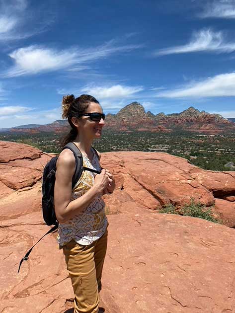
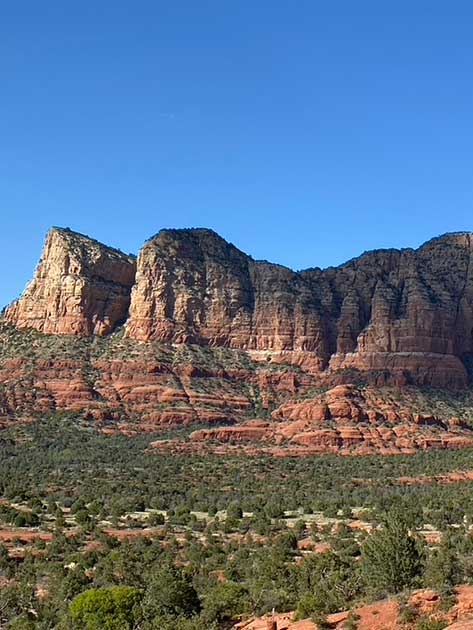
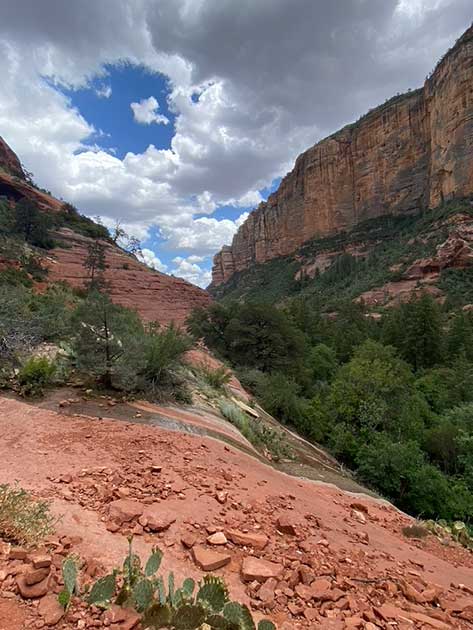
Airport Loop

Hiking Airport Loop: What You Need To Know
- Difficulty: Easy / Moderate
- Hike type: Loop
- Distance: 3.3 miles, if you park in 1 of the 9 spots at the trailhead.
- Vortex: Yes. It is located at the trailhead at Airport Mesa. Go up the steps to the left and sit on the mesa.
- Our Highlight: The view from the trailhead looking out into the valley and spending time with the Airport Mesa Vortex.
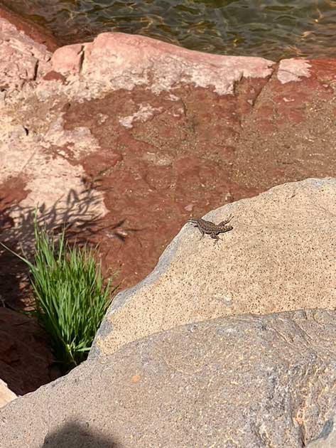
Pictures of Airport Loop

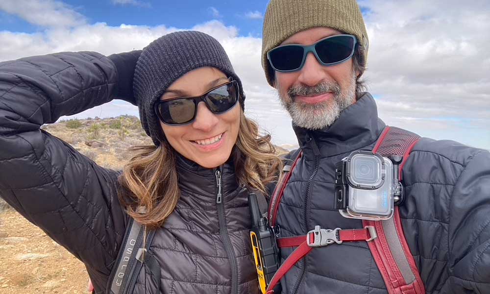
Our Experience Hiking Airport Loop
We hiked Airport Loop twice during our trip, once by ourselves in the evening on the day we arrived and another time with friends early in the morning.
Airport Loop has a great view on the first half of the hike. Once you turn the bend you start to have less of a view, but what you have is still great until you are walking the fence line in the bush. The hike was very manageable and well-marked the entire way, and we say a handful of lizards which is always fun.
Our Experience with The Vortex at Airport Loop
The Airport Mesa Vortex magical. I encourage you to sit on top of the overlook that looks out into the valley for a while, be quite, and tune into your surroundings.
Millions of people visit Sedona every year to experience the vortex energy, get healing, and meditate with vortexes. From my experience, the vortexes at Sedona have something to say if you can be quiet and are open to listening.
The camera in my iPhone exhibited some very interesting behavior at the Airport Mesa Vortex as you can see from my video below.
How to get to the Airport Loop Trailhead & Airport Mesa
You can drive your car to Airport Loop Trailhead which is right off of Airport Rd. Turn at the CVS off of 89A and go up the hill about a minute or two until you hit the parking lot.
Parking at Airport Loop & Airport Mesa can be a little tricky. There are only 10 parking spaces in front of the trailhead but there is a paid parking lot with a lot of room if you keep driving up the hill. It cost $3 to park there all day when we were there. Parking your car in this lot will add another mile to hiking Airport Loop.
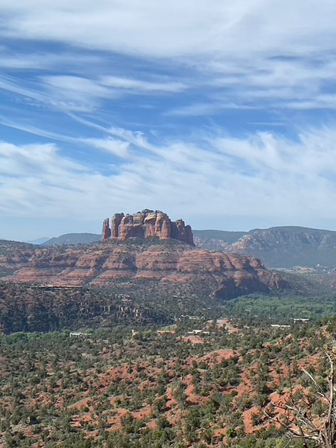
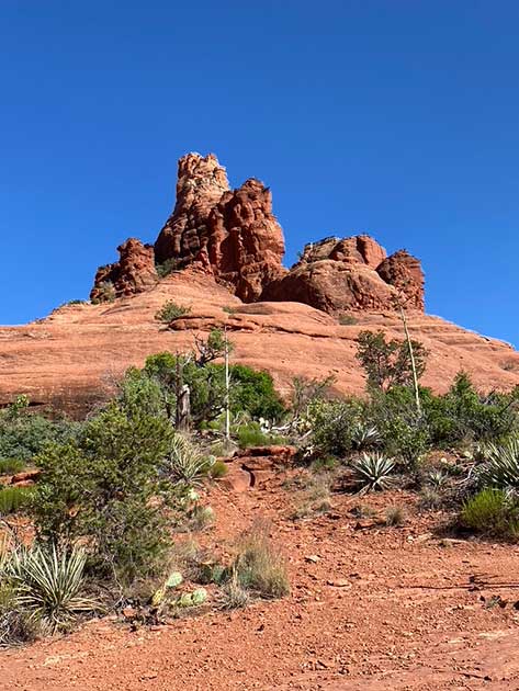
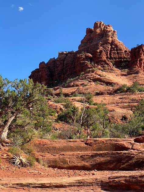
Cathedral Rock

Hiking Cathedral Rock: What You Need To Know
- Difficulty: Medium / Difficult
- Hike type: Out and back
- Distance: 1.4 miles
- Vortex: The entire area is the vortex as far as I can tell.
- Our Highlight: The entire Cathedral Rock area was fantastic.
Pictures of Cathedral Rock

Our Experience Hiking Cathedral Rock
What starts out as an easy walk from the parking lot quickly turn into a challenging scramble up Cathedral Rock. Even getting up the base can be challenging as there are many steep ledges that can be slippery with loose small rocks.
I think much of Cathedral Rock is very doable for most people. This assumes you don’t get intimidated, don’t have mobility issues, and have a plan for getting up and down. It may be a case of “if you think you can or you can’t, you are right” for many people. Do what is comfortable.
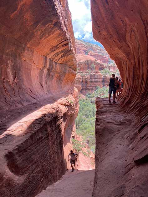
There is a tight vertical section that only allows for one person to get up or down at a time. This section is essentially the keyhole to getting to greater elevation at Cathedral Rock.
Use a backpack to carry your supplies on this hike. You will want both hands free as you ascend Cathedral Rock because you will be scrambling a lot. Always keeping 3 points of contact (2 feet and at least 1 hand on the ground) will help you get up and down safely.
There are also a flat hiking trails the lead you away from the Cathedral Rock which you can do if you aren’t feeling the vertical climb up to Cathedral Rock Viewpoint. We hiked Templeton Trail which is left of Cathedral Rock.
Our Experience with The Vortex at Cathedral Rock
The vortex energy at Cathedral Rock was palpable. I read a little bit about the vortexes in Sedona before this trip. My big takeaway from my research was that the energy in Sedona was heightened and intensified, so you should be very clear with your intentions when you are there because there is a good chance you will get what you asked for.
I decided to give it a shot. I asked to see “signs of wildlife,” which I quickly revised to “safe signs of wildlife” after realizing that my request should be clearer given that rattlesnakes and coyotes live in the desert. Within 5 minutes, I found a red-tailed hawk feather on our trail.
I’m a natural skeptic. I figured finding a feather could have been just dumb luck. So, I decided to make another request of the Cathedral Rock Vortex.
As we hiked our way back to the Cathedral Rock parking lot on Templeton Trail, I asked for some evidence of the vortex to show my wife. When I stopped to take a picture of Cathedral Rock the image in my camera started to shake violently. It was bouncing around and was warped.
I quickly turned the iPhone to video mode to see if I could capture what was happening on the phone. It did. Check out my video below and make your own conclusions. Better yet, go experience the Sedona vortexes.
How to get to the Cathedral Rock Trailhead
You must use the Sedona Shuttle to get to the Cathedral Rock Trailhead. It’s free, easy and it got packed quickly during the off-season when we were in Sedona. Plan accordingly.
Slide Rock State Park

Hiking Slide Rock Route at Slide Rock State Park: What You Need To Know
- Difficulty: Moderate
- Hike type: Out and back
- Distance: .3 miles
- Vortex: NA
- Our Highlight: Relaxing with the sounds of Oak Creek.
Pictures of Slide Rock State Park


Our Experience Hiking Slide Rock Route at Slide Rock State Park
Slide Rock State Park is great for family picnics and getting out of the heat of Sedona. Its main attraction is a natural water slide as its name suggests.
We spent most of our time at Slide Rock hiking along Oak Creek via the Slide Rock Route Trail. It gave us much-needed break from the heat we experienced hiking in Sedona.
The drive from Sedona to Slide Rock is about 7 miles away, depending on where you are staying in Sedona, and takes about 25 minutes, depending on the time of year. It cost us $20 for our vehicle to enter the park.
Slide Rock is a beautiful state park, and it is very different than the hiking and vortexes you will find in Sedona.
Slide Rock State Park is a great resource if you are visiting Slide Rock State Park.
How to get to Slide Rock State Park
Drive on 89A N for about 7 miles (about 25 minutes) from Sedona. Slide Rock State Park will be on your left. Look for the line of cars at the left turn lane at the entrance of the park and have your payment ready.
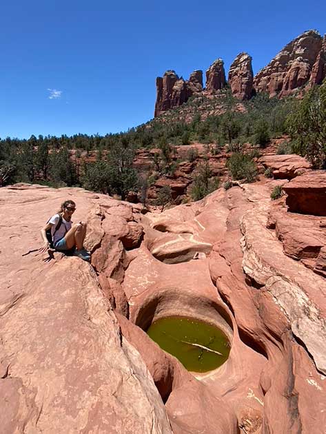
Soldiers Pass Including Devil’s Kitchen Sinkhole, Seven Sacred Pools & Soldiers Pass Cave Spur
Hiking Soldiers Pass, Seven Sacred Pools & More: What You Need To Know
- Difficulty: Easy / Moderate
- Hike type: Out and back
- Distance: 4.1 miles
- Vortex: NA
- Our Highlight: Devil’s Kitchen Sinkhole, Seven Sacred Pools, & Soldiers Pass Cave Spur.
Pictures of Soldiers Pass & Seven Sacred Pools

Our Experience Hiking Soldiers Pass
Soldier’s Pass Trail is one of those trails that should have been rated higher in terms of difficulty. While most of the trail is easy, you should know that hiking up to the cave and to where Soldiers Pass meets Brins Mesa Trail can be both challenging and rewarding, especially if it is hot.
This trail gives you access to a few Sedona hiking gems, including the aforementioned Soldiers Pass Cave Spur, Devil’s Kitchen Sinkhole, and Seven Sacred Pools.
Speaking of the Devil’s Kitchen Sinkhole, it is very close to the trailhead of Soldiers Pass. The contrast of seeing a big ol’ hole in the ground is interesting after spending most of your time looking up at all the red rocks.
Arizona.edu has a great aerial picture of the sinkhole that really gives you a sense of how big it is.
The Seven Sacred Pools were a unique rock formation even if there wasn’t much water in them. You will encounter the pools easily by keeping on the main trail of Soldiers Pass.
We went up to the Soldiers Pass Cave Spur but didn’t go in as I was nursing an injury and wasn’t feeling comfortable with the loose rocks on the climb up and down. You will need to detour off the main trail in order to explore the cave.
We hiked Soldiers Pass until it intersected with Brins Mesa Trail and then we turned around for our return hike back to the trailhead.
All of the trails in Sedona have something special about them and Soldiers Pass has a few dynamic pieces of landscape that would be tough to find just about anywhere else. Don’t miss this hike in Sedona.
How to get to the Soldier’s Pass Trailhead
You will need to park in the Soldier’s Pass Trailhead parking lot and take the free shuttle bus from there. There is not a lot of room in the parking lot. Getting there early will be your best bet and you can also find parking alongside the roads leading up to the parking lot.
We were lucky to get back to the trailhead 15 minutes before the shuttle arrived to pick us up to take us back to our car. If we missed the shuttle, we would have needed to wait 2 more hours for the next one. Be aware of the shuttle schedule pick-up times. You don’t want to be stuck in the sun and heat for 2 extra hours, exhausted with little food or water.
Bell Rock

Hiking Bell Rock: What You Need To Know
- Difficulty: Easy
- Hike type: Out and back
- Distance: .08
- Vortex: Yes!
- Our Highlight: Scrambling up Bell Rock
Pictures of Bell Rock
Our Experience Hiking Bell Rock
The hike from the parking lot to Bell Rock is easy. However, scrambling up and getting down from Bell Rock is a different story.
We hit Bell Rock late in the day after another hike and we were pooped. I was too tired to figure out how to get higher from my vantage point.
We scrambled up enough to feel like we accomplished something and popped a squat to enjoy the view. There were people much higher on the bell than we were, that is for sure.
After sharing my experience with a friend who has hiked Bell Rock in the past, he told me that the far side of Bell Rock, furthest away from the parking lot, is easier to climb than where we were.
I want to get to the peak of Bell Rock next time. I imagine the view is pretty awesome.
Our Experience with The Vortex at Bell Rock
I had a little interaction with the vortex at Bell Rock, but for me it paled in comparison to Airport Mesa, Cathedral Rock and Kachina Woman. I have heard others having magical experiences there. Don’t let my experience deter you from exploring the Bell Rock vortex.
How to get to The Bell Rock Trailhead
There is a dedicated parking lot at the Bell Rock Trailhead.
You will need to get a parking pass at the machine. I don’t recall how much it was, but I don’t remember it being more than a few bucks. You can always park across the street if it’s too busy or you don’t want to pay the fee.
Boynton Canyon Including The Subway Cave & Kachina Woman

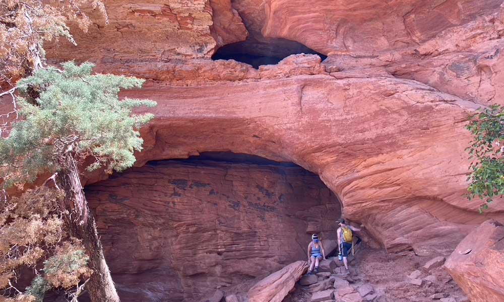
Hiking Boynton Canyon, The Subway Cave & Kachina Woman: What You Need To Know
- Difficulty: Moderate
- Hike type: Out and back
- Distance: 7.2 miles
- Vortex: Yes, at Kachina Woman
- Our Highlights: Kachina Woman, The Subway Cave and hiking out to the bowl at the end of Boynton Canyon
Pictures of Boynton Canyon, The Subway Cave & Kachina Woman

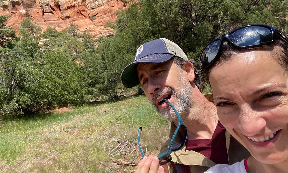
Our Experience Hiking Boynton Canyon & The Subway Cave
We hiked a total of about 9 miles on Boynton Canyon Trail. It starts off with access to The Kachina Woman, which is just off the main trail.
After you get through the desert part of the trail you can make a right to explore The Subway Cave. I highly suggest using the AllTrails app to help get you there and back. Even with the app we got a little lost on our return trip back to the main trail.
The Boynton Canyon Trail was our favorite hiking trail in Sedona by far. It has a mix of red rocks, desert, sandy trail, and forest, which culminates in a big rock bowl at the end of the trail.
We stopped at the end of the trail for a bite to eat. Clouds came in and it started to rain a little, so we left to avoid slippery rocks and the off-chance of a flash flood (no rain was forecasted for the day).
Boynton Canyon Trail was pretty easy, though you needed stamina to complete the minimum of 7.2 miles. Getting to The Subway Cave required more agility, a tolerance for heights, and added about 1.25 miles to our total distance.
This was a long hike. Plan for it and have a great time.
Our Experience with The Kachina Woman Rock Vortex at Boynton Canyon
The Kachina Woman Rock vortex was incredible (Note: Some people refer to the Kachina Woman as the Boynton Pass Vortex due its location.)
We did a brief meditation there to tune into the energy of the vortex. It didn’t disappoint. I’d go back to Sedona just to spend more time with the Kachina Woman (and to get pizza from Gerardo’s).
How to get to Boynton Canyon Trailhead
The trailhead is near the Enchantment Resort off of Boynton Canyon Road. You will see signs for
the trailhead as you approach the resort. The lot is bigger than many of the other trailhead
parking lots but fills up quickly. Getting there early is always better than getting there later.
Where We Stayed
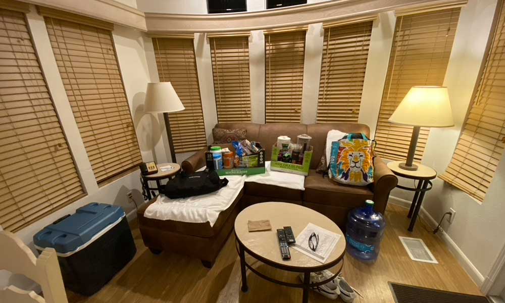
We stayed at Sedona Pines Resort during our stay in Sedona. We liked that it was about 15 minutes out of town off Highway 89A. We wanted to stay out of the hustle and bustle of Sedona proper.
The resort was undergoing an asphalt project, resulting in only half of the units being occupied while we were there. That made our stay even quieter. I doubt we will luck into that situation again, but it was good while we had it.
The Sedona Pines Resort is family-friendly and part of a timeshare complex. You can stay there without being a member but be prepared to get pitched.
Also, the pictures make the units look like individual cabins. However, they are mobile home units and did the job just fine.
I’ll keep Sedona Pines Resort on our short list of places to stay when we return.
Where We Ate

If you visit Sedona during the high season between March to May and September to November, make reservations. We got by with walking into everywhere we went to eat but we were also in Sedona in June.
Mariposa Latin Inspired Grill
This place gets packed. We were lucky to get into the restaurant around 8 PM. We came in right after hiking Airport Loop and were dirty, still wearing our hiking gear. We ended up sitting at the bar. There was a sign suggesting that there was a dress code, but we didn’t observe it being enforced.
The ambiance was great. The food was mediocre. The cocktails were wonderful.
Visit: https://www.mariposasedona.com/
Shorebird
Shorebird had plenty of room during the week. It offered good drinks, and tasty appetizers and entrees. The carrot cake was my favorite thing on the menu.
It was a solid choice and you paid for it. Read: it was a little pricey and worth a visit.
Visit: https://shorebirdrestaurant.com/locations/sedona/
Gerardo’s Pizzeria
Gerardo’s has possibly the best pizza I have ever had. I’m originally from NJ and spent time in NY. I know good Italian food and I would put my money on Gerardo’s in a pizza contest.
In addition to the wonderful food, the wine was top-notch, and the staff was fantastic.
Visit: https://gerardospizzeria.com/
The Hudson
We stopped into The Hudson for lunch. We had a typical burger and fries meal and it was very good.
Dinner looked pricey but I would give The Hudson a shot before returning to Mariposa Latin Inspired Grill or Shorebird again.
Visit: https://the-hudson.popmenu.com/
The Secret Garden Cafe
It was a little touristy, but they had legit Mexican food and live entertainment. A good choice.
Visit: https://sedonasecretgardencafe.com/
Summary
I didn’t understand how magical Sedona was no matter how much I read about it until we visited it. You need to experience Sedona to really appreciate it. I hope you get the chance to do that.